Category:Ashland, Kentucky
Jump to navigation
Jump to search
city in Boyd County, Kentucky, United States  Даунтаун  | |||||
| Upload media | |||||
| Instance of | |||||
|---|---|---|---|---|---|
| Location | Boyd County, Kentucky | ||||
| Inception |
| ||||
| Population |
| ||||
| Area |
| ||||
| Elevation above sea level |
| ||||
| Different from | |||||
| official website | |||||
 | |||||
Subcategories
This category has the following 6 subcategories, out of 6 total.
Pages in category "Ashland, Kentucky"
This category contains only the following page.
Media in category "Ashland, Kentucky"
The following 43 files are in this category, out of 43 total.
-
 AC&I office site.jpg 6,016 × 4,000; 5.9 MB
-
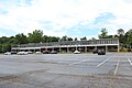
 AC&I Store, Ashland.jpg 6,016 × 4,000; 6.12 MB
-
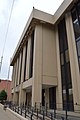
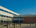 ACTC Main.jpg 600 × 471; 81 KB
-
 AKH-AH14.jpg 554 × 522; 114 KB
-
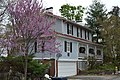
 Alexander Bagby House.jpg 2,816 × 2,112; 1.4 MB
-
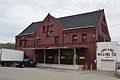
 Amtrak Ashland, KY station.jpg 3,968 × 2,232; 3.45 MB
-
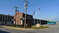
 Amtrak depot in Ashland.jpg 6,016 × 4,000; 6.03 MB
-
 Ashland Armory front.jpg 2,816 × 1,584; 1.09 MB
-
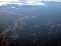
 Ashland KY pan oct 14 2006.JPG 3,045 × 1,353; 864 KB
-
 Ashland KY WV banner.jpg 4,000 × 572; 1.79 MB
-
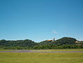 Ashland Regional Airport KY.JPG 1,632 × 1,232; 815 KB
-
 Ashland TB Hospital.jpg 6,016 × 4,000; 6.45 MB
-
 Ashland, KY, USA - panoramio.jpg 1,600 × 1,200; 510 KB
-
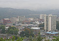 AshlandKY Downtown.jpg 378 × 261; 87 KB
-

-
 Camayo Arcade.jpg 399 × 600; 123 KB
-
 Carl Perkins Federal Building.jpg 4,000 × 6,016; 5.26 MB
-
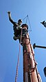 Climbing on top of KET WKAS Ashland analog tower.jpg 360 × 640; 27 KB
-

-

-
 Country Music Highway - Kentucky Highlands Museum - NARA - 7717842.jpg 2,974 × 1,980; 1.49 MB
-
 Country Music Highway - Kentucky Highlands Museum - NARA - 7717843.jpg 2,961 × 1,993; 1.43 MB
-
 Crump and Field Grocery Company.jpg 4,000 × 6,016; 6.51 MB
-
 Culbertson House in Ashland.jpg 6,016 × 4,000; 6.39 MB
-
 Downtown Ashland, KY.jpg 4,056 × 2,280; 4.15 MB
-

-
 Greetings from Ashland, Kentucky - Large Letter Postcard (11537838075).jpg 1,000 × 638; 800 KB
-

-
-
-
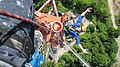 KET WKAS Ashland analog tower 2009 tech leaning out.jpg 640 × 360; 73 KB
-
 Krager-park.jpg 500 × 375; 95 KB
-
 Martin Hilton House.jpg 6,016 × 4,000; 6.49 MB
-
 Nando Felty Saloon site.jpg 6,016 × 4,000; 6.53 MB
-
 Our Lady of Bellefonte Hospital.JPG 4,272 × 2,848; 5.34 MB
-
 PaulGBlazerHighSchool AshlandKentucky.jpg 2,592 × 1,728; 2.9 MB
-
-
 Photograph of President William Jefferson Clinton addressing a crowd (cropped).jpg 1,218 × 1,481; 730 KB
-
 Photograph of President William Jefferson Clinton addressing a crowd.jpg 3,150 × 2,099; 1.9 MB
-
 Saint-Pauls-Ashland-Ky.jpg 2,592 × 1,944; 3.89 MB
-
 Savageot House and Saloon behind floodwall.jpg 6,016 × 4,000; 5.88 MB
-
 St James AME, Ashland.jpg 6,016 × 4,000; 6.36 MB
-
 Venus of Ashland, Kentucky.jpg 480 × 622; 116 KB


.jpg)
.jpg)


.jpg)
.jpg)
.jpg)
.jpg)
.jpg)


.jpg)
.jpg)


